Ziyuan Series
l Ziyuan-1 02C satellite
The Ziyuan-1 02C satellite is a satellite that fills the gap in China's domestic high-resolution remote sensing data. It was launched on December 22, 2011 and operates in a sun-synchronous orbit with an orbital altitude of 780.099km. The satellite weighs about 2100 kg. The total power of satellite is about 1250W. The design lifetime is 3 years. The satellite is equipped with a panchromatic/multispectral (P/MS) camera and a panchromatic high resolution (HR) camera. The P/MS camera has a resolution of 10m and a width of 60km. Two HR cameras with a resolution of 2.36m make the data width reach 54km. The main task of the satellite is to obtain panchromatic and multispectral image data, which can be widely used in land and resources survey and monitoring, disaster prevention and mitigation, agriculture, forestry and water conservancy, ecological environment, major national projects and other fields. The satellite user is the Ministry of Land and Resources of China

ZY-1 02C
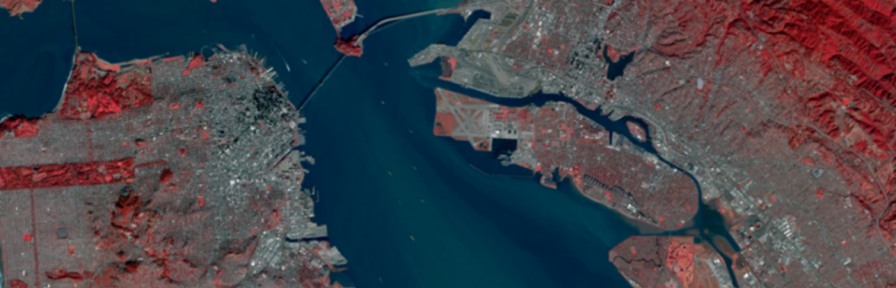
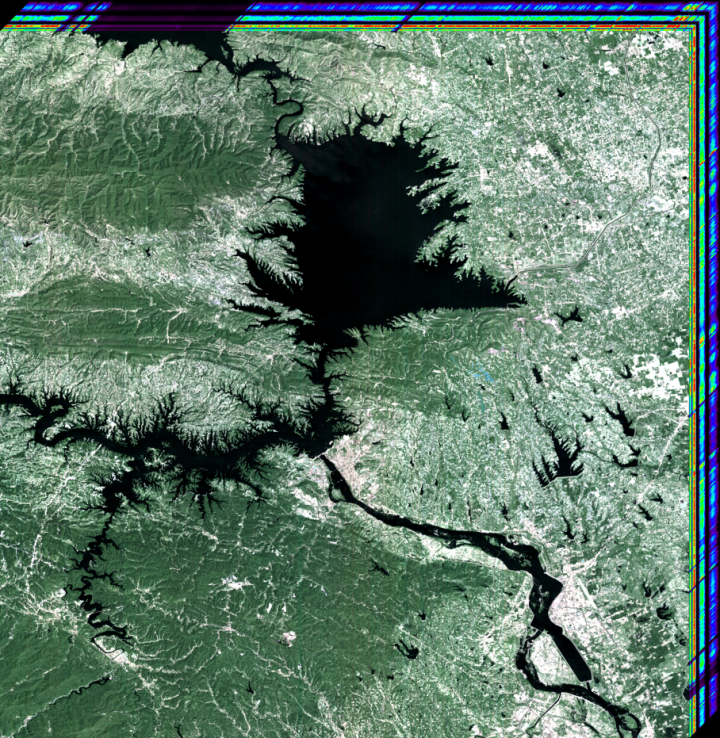
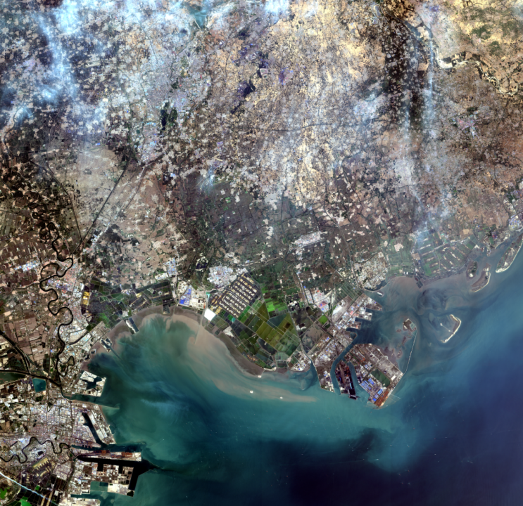
A fused image acquired by ZY-1 02C
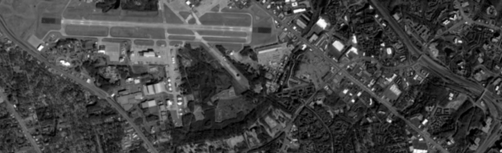
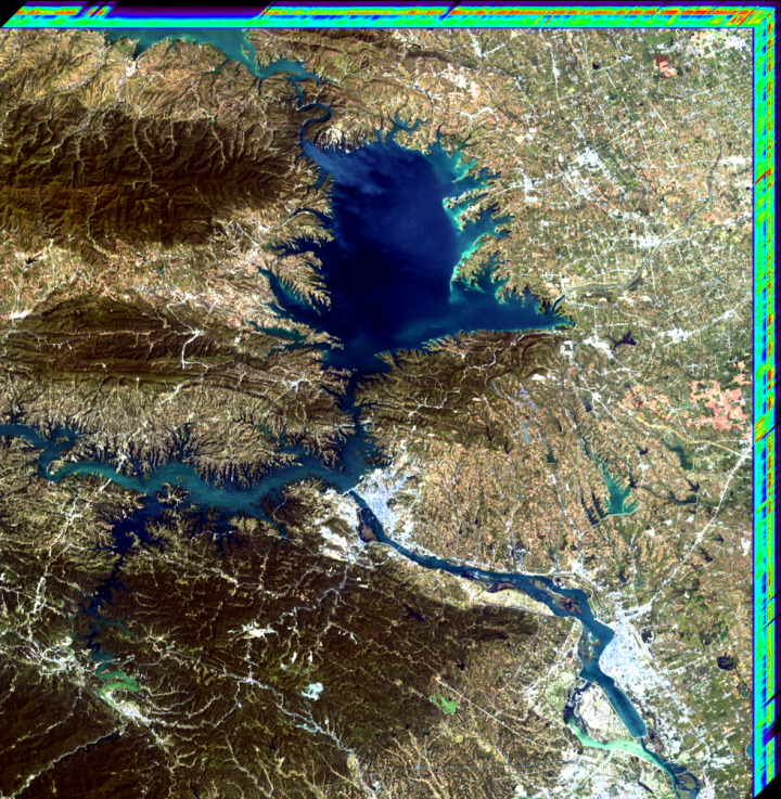
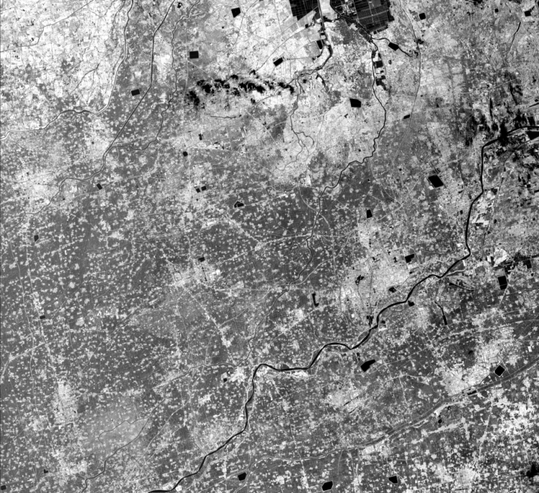
A panchromatic image acquired by ZY-1 02C
l Ziyuan-1 02D satellite
The Ziyuan-1 02D satellite (The 5-meter optical satellite) was successfully launched on September 12, 2019, running in a sun-synchronous orbit with an orbital altitude of 780.099 km. The satellite weighs about 1900 kg. The total power of satellite is about 1600W. the satellite carrying two payloads, a visible and near-infrared camera and a hyperspectral camera. On the basis of the traditional four multispectral spectrum bands, the visible and near-infrared camera has added the coastal blue band, yellow band, red edge band and another near-infrared band, with a spatial resolution of 2.5m/10m and a width of 115km. The hyperspectral camera realizes the simultaneous acquisition and download of data of 166 spectral bands, with a spatial resolution of 30m, a spectral range of 0.4-2.5um, a spectral resolution of 10/20nm, and a width of 60km. the satellite data can be used in the process of geological and mineral exploration and land supervision, quantitative extraction and identification of ground object information, which meets the needs of natural resource remote sensing for comprehensive monitoring of elements such as mountains, water, forests, fields, lakes, and grasses, and more applications. The main user of the satellite is the Ministry of Natural Resources.
ZY-1 02D
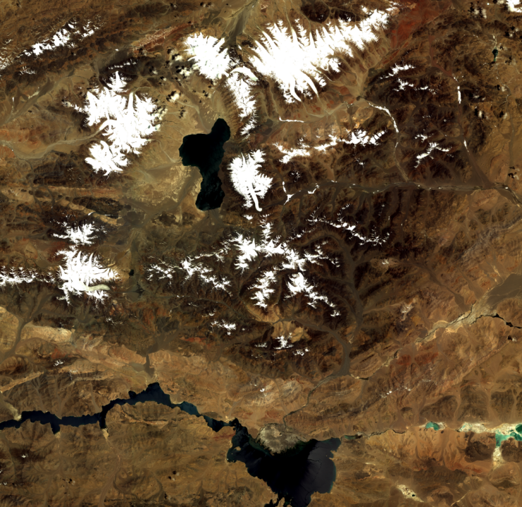
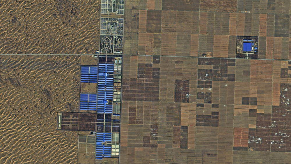
A multispectral image of Ngari Prefecture in Tibet acquired by ZY-1 02D, taken on July 11th, 2020
The spectral cube(SWIR on left, VNIR on right) of Danjiangkou Reservior acquired by ZY-1 02D
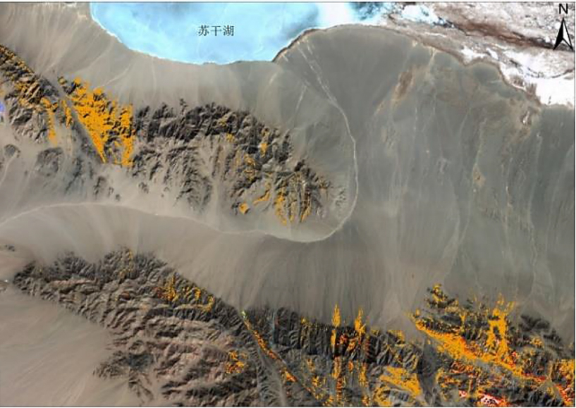
The hyperspectral mineral resource survey
l Ziyuan-1 02E satellite
The Ziyuan-1 02E satellite (The 5-meter optical 02 satellite) was successfully launched on December 26, 2021, running in a sun-synchronous orbit with an orbital altitude of 780.099 km. The satellite weighs about 2550 kg. The total power of satellite is about 2200W. The Ziyuan-1 02E satellite is the constellation satellite with Ziyuan-1 02D satellite, which carries the same two visible and near-infrared camera and hyperspectral camera. On the basis of this, the satellite added a infrared camera, which can realize all-day earth observation.
ZY-1 02E
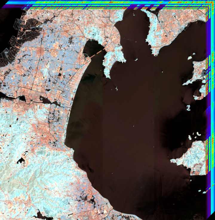
A multispectral image of Tangshan acquired by ZY-1 02E, taken on May 17th, 2022
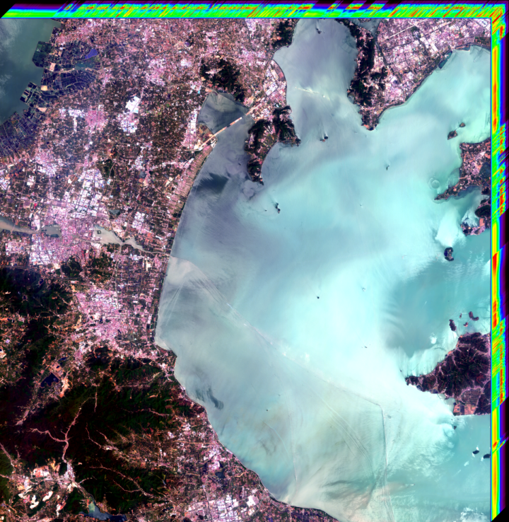
A infrared image of Binzhou in Shandong province acquired by ZY-1 02E, taken on May 17th, 2022
The spectral cube(SWIR on left, VNIR on right) of Lake Tai acquired by ZY-1 02E
l Ziyuan-1 04/04A satellite
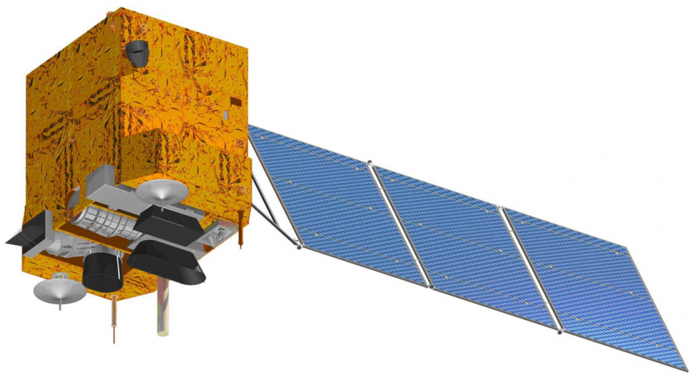
CBERS 04
CBERS 04 is the fifth remote satellite of China and Brazil Earth Resource Satellite with the same design and products as CBERS 03. Under the framework of cooperation between China and Brazil government, CBERS 04 was designed by CAST and INPE. The remote sensing data is used in agriculture assessment, environmental protection, city planning and land resource survey. The satellite was launched on Dec. 7, 2014.
CBERS 04 has 4 cameras. One of the main payloads is a CCD camera with 5 meters resolution in panchromatic spectrum and 10 meters resolution in multi-spectrum, the swath of imaging is 60km. the other one is a infrared camera with 80 meters resolution in thermal infrared spectrum and the swath is 120km. CBERS 04 employed ZY-1000 platform of CAST. Satellite works in SSO of 778km altitude and the designed lifetime is 3 years. The satellite has a 2076kg mass and 2400W power consumption in end of life.
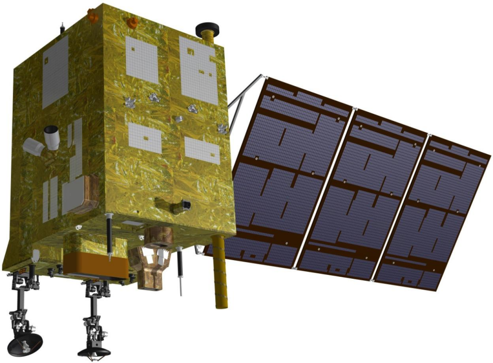
CBERS 04A
CBERS 04A is the sixth remote satellite of China and Brazil Earth Resource Satellite. Still under the framework of cooperation between China and Brazil government, CBERS 04A was designed by CAST and INPE. The satellite has the role to continue CBERS remote sensing data and satisfy using requirement of both countries such as agriculture assessment, environmental protection, city planning and land resource survey. Considering the requirement of covering a whole city in one imaging, the payload has the ability of not only high resolution also wide swath. The satellite was launched on Dec. 20, 2019.
CBERS 04A has 3 cameras. The main payload is a CCD camera with 2 meters resolution in panchromatic spectrum and 8 meters resolution in multi-spectrum, the swath of imaging is 90km. CBERS 04A also employed ZY-1000 platform of CAST. Satellite works in SSO of 628km altitude and the designed lifetime is 5 years. The satellite has a 1727kg mass and 2400W power consumption in end of life. The geo-location error is 50 meters (without GCP) and the satellite has an attitude maneuver ability of 32 degree around X axis.
ZY-1 04A
ZY-1 04
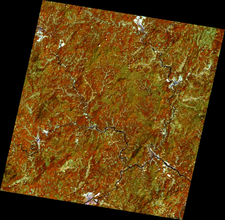
A fused image of visible and infrared images acquired by ZY-1 04
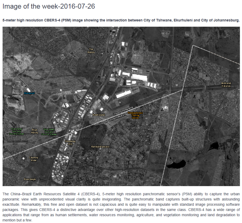
ZY-1 04A

A wide-swath fused image of panchromatic and multispectral images acquired by ZY-1 04A
A wide-swath fused image of panchromatic and multispectral images of Nanhu Town acquired by ZY-1 04A