Remote Sensing Satellite Ground System
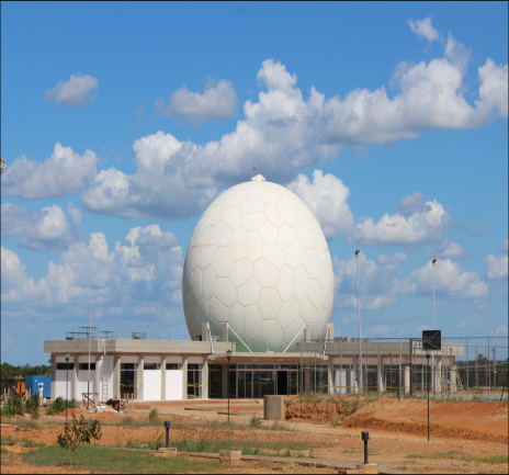
Remote Sensing Satellite Ground System, as the ground infrastructure of remote sensing satellite, consists of two parts: Ground Control System and Ground Application System. The Ground Control System is capable to perform telemetry (TM) data processing, telecommand (TC) generation and sending to remote sensing satellite, and providing the satellite orbit determination and maneuver. The Ground System can be in the form of fixed ground system or transportable ground system. The fixed ground station includes antenna, reception channel, data recording, satellite TT&C channel, station monitor and control and technology support utilities, which shall provide the remote sensing data receiving, demodulation, raw data recording, tracking, telemetry and telecommand functions. The Ground Application System can provide users with the capability of whole service chain such as satellite operation management, data receiving, data processing, data management and data application. The remote sensing data can be used in agriculture, forestry, water conservancy, marine, environment, disaster reduction, land surveying and mapping, public security, meteorological products, meteorology and other fields. Remote Sensing Satellite Transportable Ground System is a set of convenient-to-operate system based on the vehicle-mounted mobile platform with real-time image data receiving and processing, satellite measurement and control.
Remote Sensing Satellite Ground System
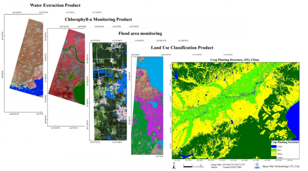
Valued-added Application
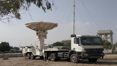
Remote Sensing Satellite Transportable Ground System Diagram
More details :
![]() Remote sensing application on natural disaster.pdf
Remote sensing application on natural disaster.pdf
![]() Remote sensing application on mining.pdf
Remote sensing application on mining.pdf
![]() Remote sensing application on forestry.pdf
Remote sensing application on forestry.pdf